Mayor's Tour Bürgermeistersteig over the Hohe Kreuz
Hiking & mountain tour
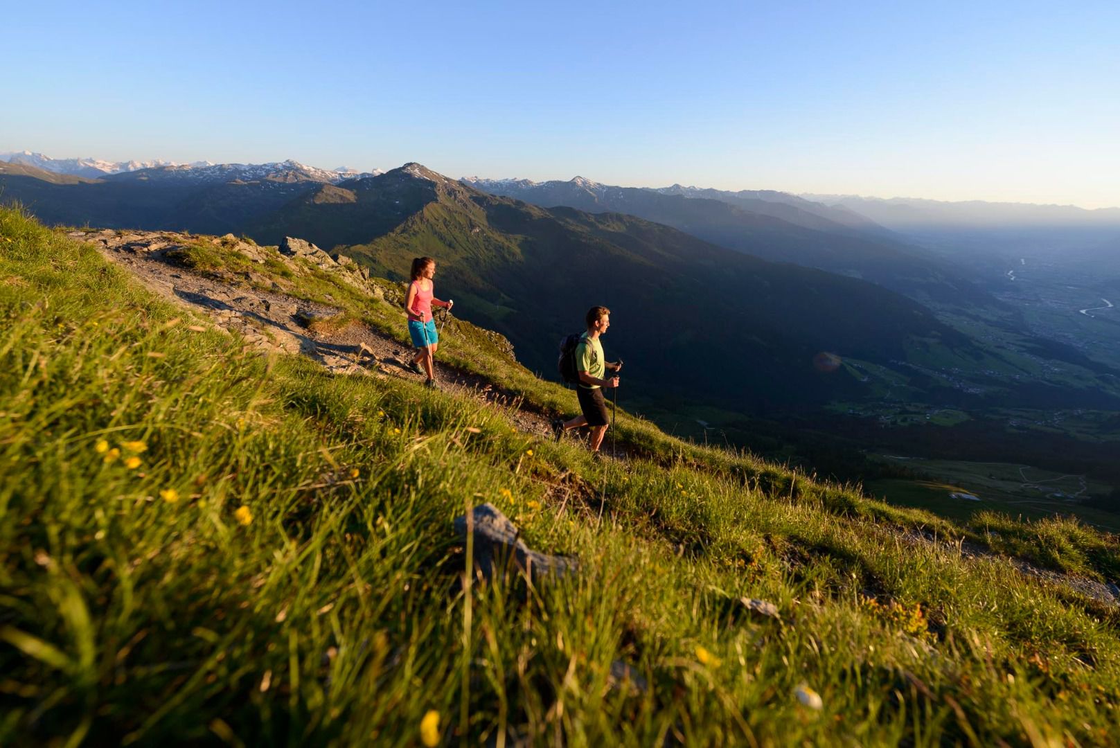
Of the high trails above the silver town of Schwaz, the Bürgermeistersteig is one of the most traditional. A wandering mayor of Schwaz had this trail built.
The first local hikers who roamed the area for pleasure will have walked on this gentle path, which was hardly ever built with difficult climbs. The new bourgeoisie was the first to take advantage of this leisure time pleasure, because until then most of the distances had to be covered on foot, which meant work and plague. Just think of the farmers and craftsmen.
From the lift station Grafenast follow the signs Bürgermeistersteig or Pirchneraste. A gentle short ascent leads to a wide forest path through the high forest and through gentle meadows. Sometimes the forest thins out and you look over the Inn valley to the rocky Karwendel. On a small path through dense forest the Talzlbach and the Proxenbach are crossed, which have cut themselves into deep ditches. The trail then leads to a worthwhile stop at Pirchneraste. After a well-earned rest, follow the path downhill in the direction of Zintberg, then turn left in the direction of the Hohes Kreuz. You will pass through the forest at the same altitude and return to sunny meadows at "Egertboden". Follow the forest path in the direction of Mittelstation/Arzberg. At the turn-off to the middle station, however, it is essential to keep going uphill towards Hochpillberg, Berggasthöfe. After about 100 metres you come to the junction "Alter Rodelweg, abbreviation Grafenast", which you climb uphill again, which you have walked down to the Hohe Kreuz. The starting point Grafenast is reached through romantic high forest. Good refreshment stops in the three hotels with panoramic terraces. (By the way: the "Aste" is the old word for a mountain meadow at intermediate altitude: e.g. Grafen-Aste and Pirchner-Aste!
Special features:
A mayor of Schwaz had the mayor's path laid out for gentle hikes over Schwaz in old times, since then a classic for young and old.
At a Glance | |
|---|---|
| Difficulty level: | medium difficulty |
Information | |
|---|---|
| Starting point: | Liftstation Grafenast |
| Path surface: | Beginning as a forest road, it turns into a hiking trail and then back into a forest road |
| Recommended equipment: | Good footwear, rain protection |
Route type | |
|---|---|
| Circular hike: | Yes |
| City: | Schwaz |
Recommendable for Mayor's Tour Bürgermeistersteig over the Hohe Kreuz

Pirchnerast Inn
- Place: Schwaz
Alpine inn at 1,257 m above sea level above Schwaz with a magnificent panoramic view over the Inn Valley. Starting point for hikes and mountain bike tours in summer and tobogganing fun in winter.
Read moreAccommodation in the region

Ferienwohnung
Garhof
- Place: Pill