What the hiker's heart desires...
With its total of 400 kilometers of hiking trails, the Silberregion Karwendel offers just the right thing for every friend of "Schusters Rappen". From fantastic panoramic trails to family-friendly hiking routes, which you can also walk with a stroller, this TOP hiking area in Austria really has everything to offer and is worth discovering.
.


Panoramarundweg from Schwaz to Pill
Partially open- Place: Schwaz-Pill
With no significant difference in altitude, you can enjoy the wonderful silence and coolness of the forest above the roofs of Schwaz. In addition, one of the most important sights of the silver town of Schwaz, Freundsberg Castle, can be visited.
Read more
Panoramic Circular Hike to Gilfert
- Place: Hochpillberg
The way to the Gilfert via its back side is not as gentle as over the Weerberg. But the ascent to the Gamsstein and the Graukopf off the Gilfert are characterised by particularly characteristic small landscapes of bizarre beauty.
Read more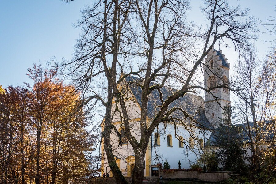
Pilgrims Path Tour
- Place: Stans
Enchanting hiking trail through the most beautiful gorge of Tyrol: the Wolfsklamm
Read more
Panorama Route Hüttegg
- Place: Weerberg
A wonderful and easy round in the Tuxer Alps with a view of the plateaus and peaks opposite.
Read more
Over the Gan Alp to the Walder Alp
Partially open- Place: Vomp
This scenic circular hike usually leads through forests, but nevertheless one enjoys many views of the mountain landscape. Passing the Ganalm and Walderalm there are a beautiful view.
Read more
From Stans to Tratzberg Castle
- Place: Stans
A leisurely hike to a particularly imposing castle at the foot of the Karwendel Mountains.
Read more
Into the Enger Grund
- Place: Eng
The Große Ahornboden (Great Maple Grounds) at the end of the toll road into Rissbachtal is a botanical rarity at an altitude of 1200 metres. On 240 hectares, framed by rugged meadows, there are over 2000 maple trees. The oldest of them have up to 600 years in the gnarled branches.
Read more
Walk to the Bucher Waterfall
- Place: Buch in Tirol
Refreshing secret tip. Short trip to rushing waters, especially attractive on hot summer days.
Read more
Panorama Hiking Trail Terfens
- Place: Terfens
The car is parked at the parish hall in Terfens. From there you walk along the path of reflection to the pilgrimage chapel Maria Larch.
Read more

Sun Side Tour at Weerberg
- Place: Weerberg
Comfortable hike, which leads past several original Tyrolean alpine pastures.
Read more
Uo to the die Binsalm Alp in the Karwendel
- Place: Hinterriss
From the Eng car park the forest path leads to the Engalm. In summer there are many cows on the mountain pasture, which characterize the landscape.
Read more
Bible Trail - Rottenburg Castle Ruin
- Place: Buch-Rotholz
Relaxing hike for body and soul, in unspoilt nature, far away from hectic and stress.
Read more
Bärenrast - Lamsenjochhütte - Eng
- Place: Eng
Durch das Stallental zur Lamsenjochhütte und hinunter zur Eng Alm. Eine atemberaubende Tour durch das Karwendel.
Read more
Circular Hike at the Kellerjoch
- Place: Hochpillberg
Attractive landscape with changing views. Particularly beautiful at the time of the alpine rose blossom at the end of June.
Read more
Freundsberg - Pirchnerast
- Place: Schwaz
Easy hike with a magnificent view over the Inn Valley.
Read more


Pioneer Path with Waterfall in Pilll
- Place: Pill
Romantic stream hike, in the narrow Pillertal valley with the waterfall as the highlight.
Read more
Stallenalm from car park Bärenrast
- Place: Stans
An easy hike for the hiker looking for peace and quiet - with full alpine experience!
Read more

Hecher-
- Place: Schwaz
Blick ohne Grenzen auf die markantesten Gipfel und Bergzüge der Ostalpen.
Read more
Ritter-Waldauf-Runde
Currently Closed- Place: Weer, Weerberg, Kolsass, Kolsassberg
A journey of discovery in the footsteps of Knight Waldauf through forests, along streams and over a suspension bridge to the ruins of Rettenberg.
Read more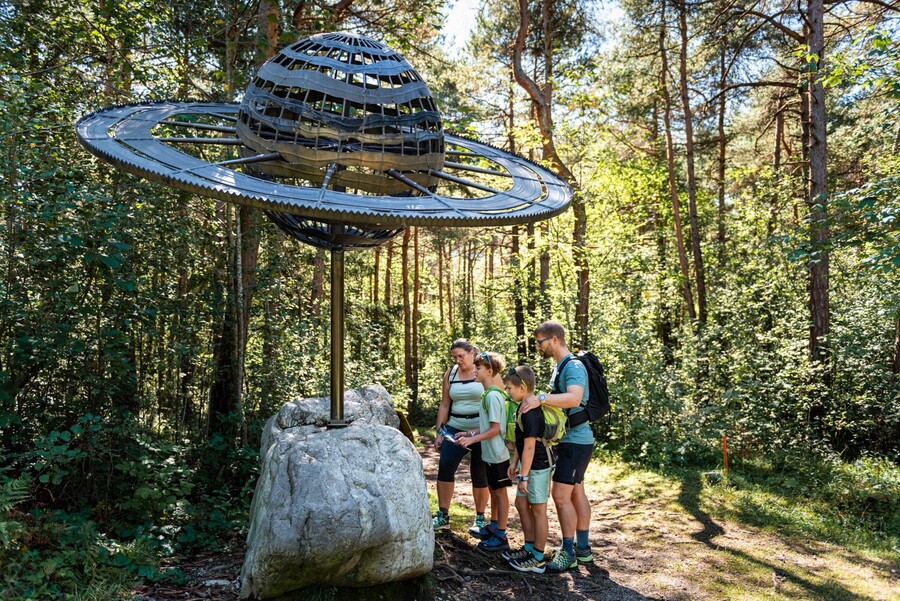
Planetary Discovery Trail
- Place: Terfens
The solar system at every turn – the Planetary Discovery Trail combines nature, knowledge and digital experiences in the Forchat Forest in Terfens.
Read more
Über den Jägersteig zur Naunzalm
Read more
Wanderung ins Vomper Loch - Der Tiroler Grand Canyon
- Place: Vomp
Vomper Loch is considered one of the wildest and most remote corners of the Karwendel. You can expect an EU-standard hike through unspoilt mountain scenery with fascinating views.
Read more
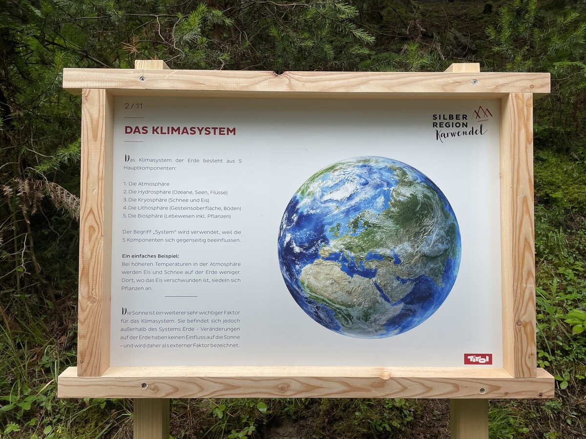
Climate Path
- Place: Vomperberg
The Climate Trail on Vomperberg is a classic nature trail where you can learn interesting facts about our planet's climate.
Read more

Weg der Sinne - Way of the Senses
- Place: Hochpillberg
Walk through characteristic alpine landscapes, rediscover your senses and marvel at the 19 works by artists.
Read more
Along the Wild Waters through the Wolfsklamm
- Place: Stans
Thundering waterfalls, emerald green pools and the fine spray of water make the gorge an impressive natural experience.
Read more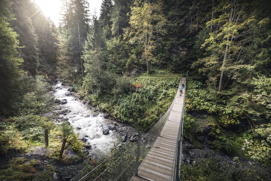
Suspension bridge tour
Currently Closed- Place: Weer/ Kolsass
Two bridges, one experience – die Hängebrückenrunde begeistert mit Naturgenuss und Abenteuer.
Read more
suspension bridge combination
Currently Closed- Place: Weer/ Kolsass
A pleasure tour for experienced hikers.
Read more
