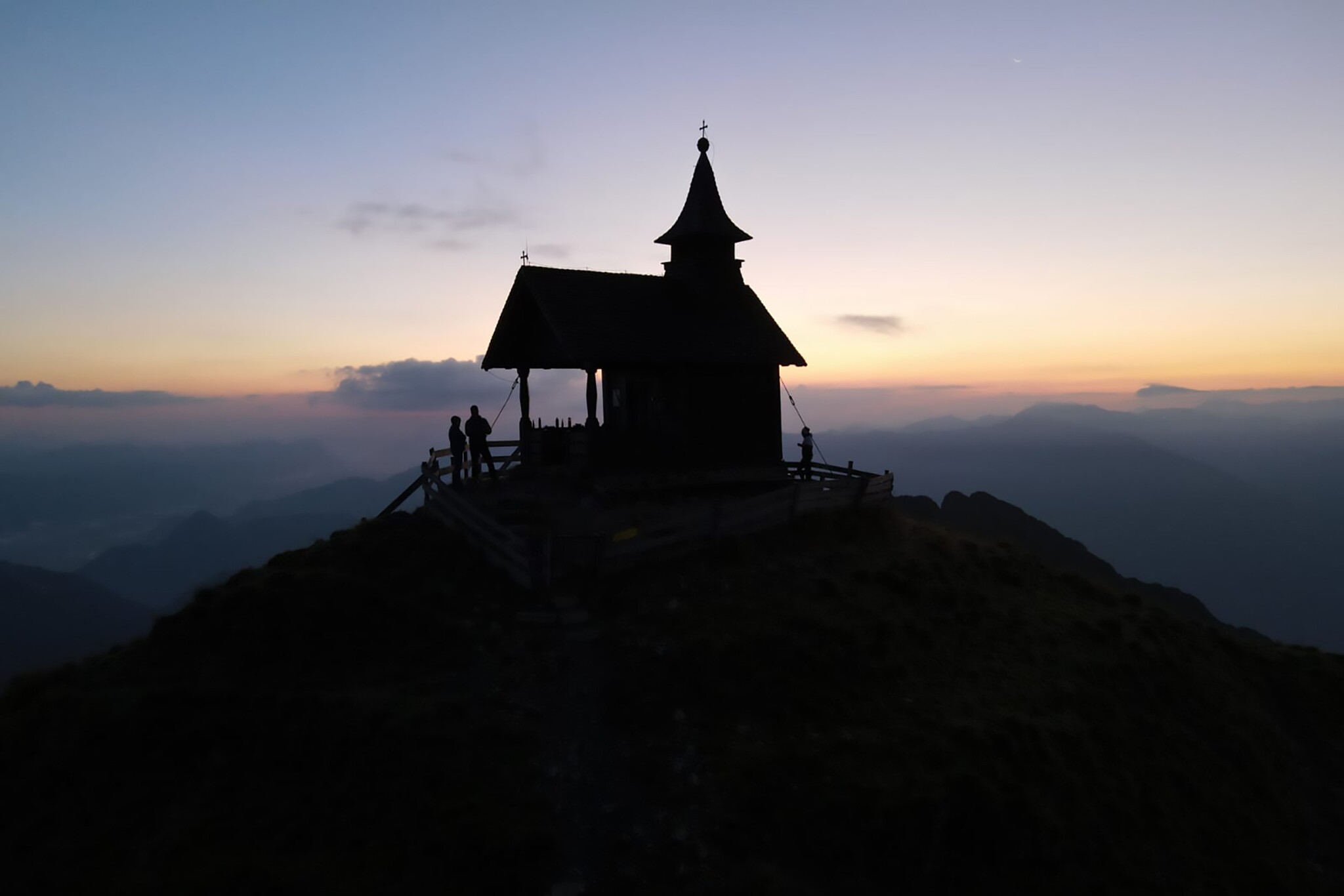
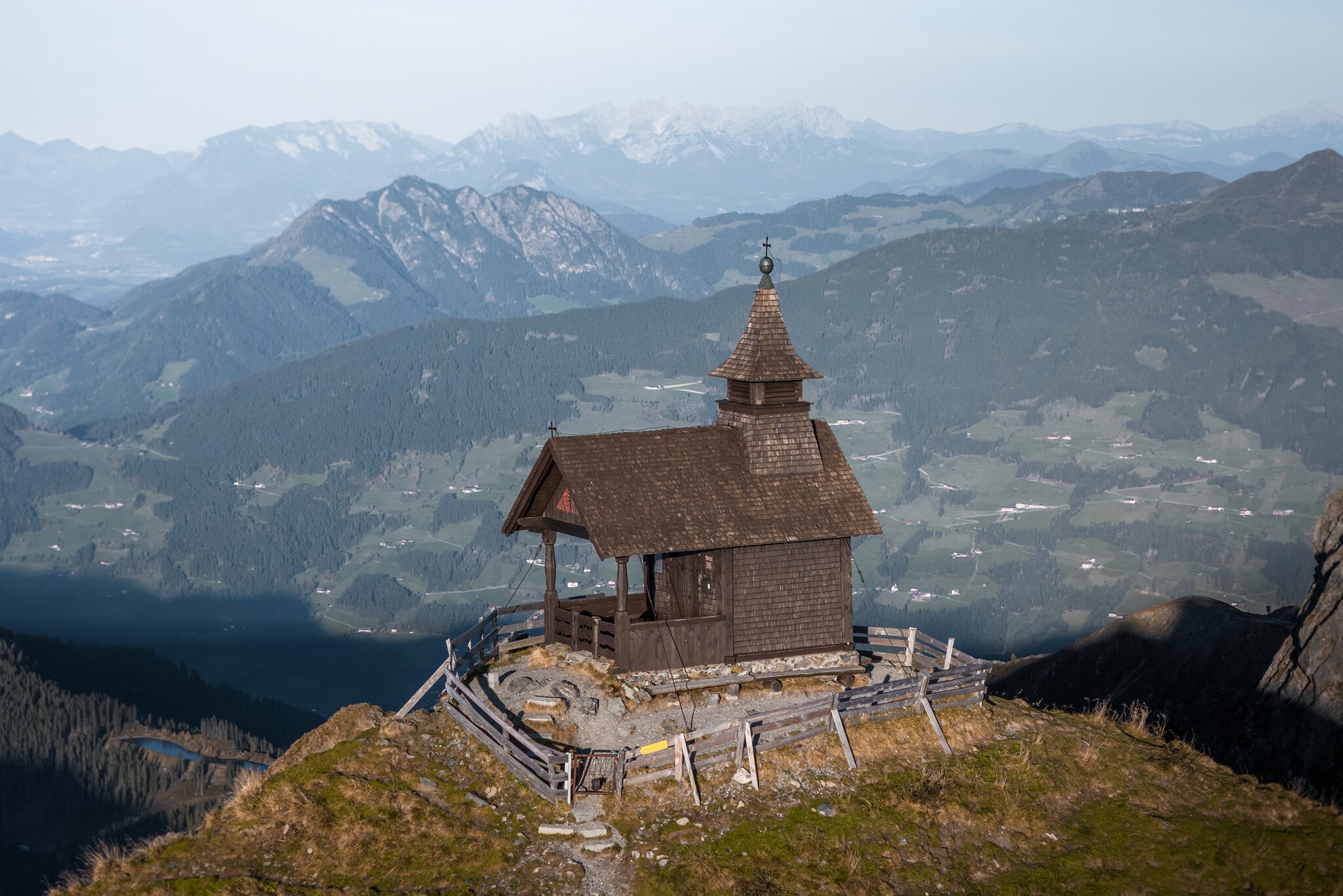
Kellerjoch Summit Chapel
Viewing platforms
High above the Inn Valley sits the Kellerjoch Chapel with its incomparable panorama – the most beautiful place in Tyrol in 2025.
A place steeped in history and splendour – and now also silver: 9 Places – 9 Treasures has awarded the Kellerjoch Chapel in the Silberregion Karwendel silver in 2025, making it the second most beautiful place in Austria.
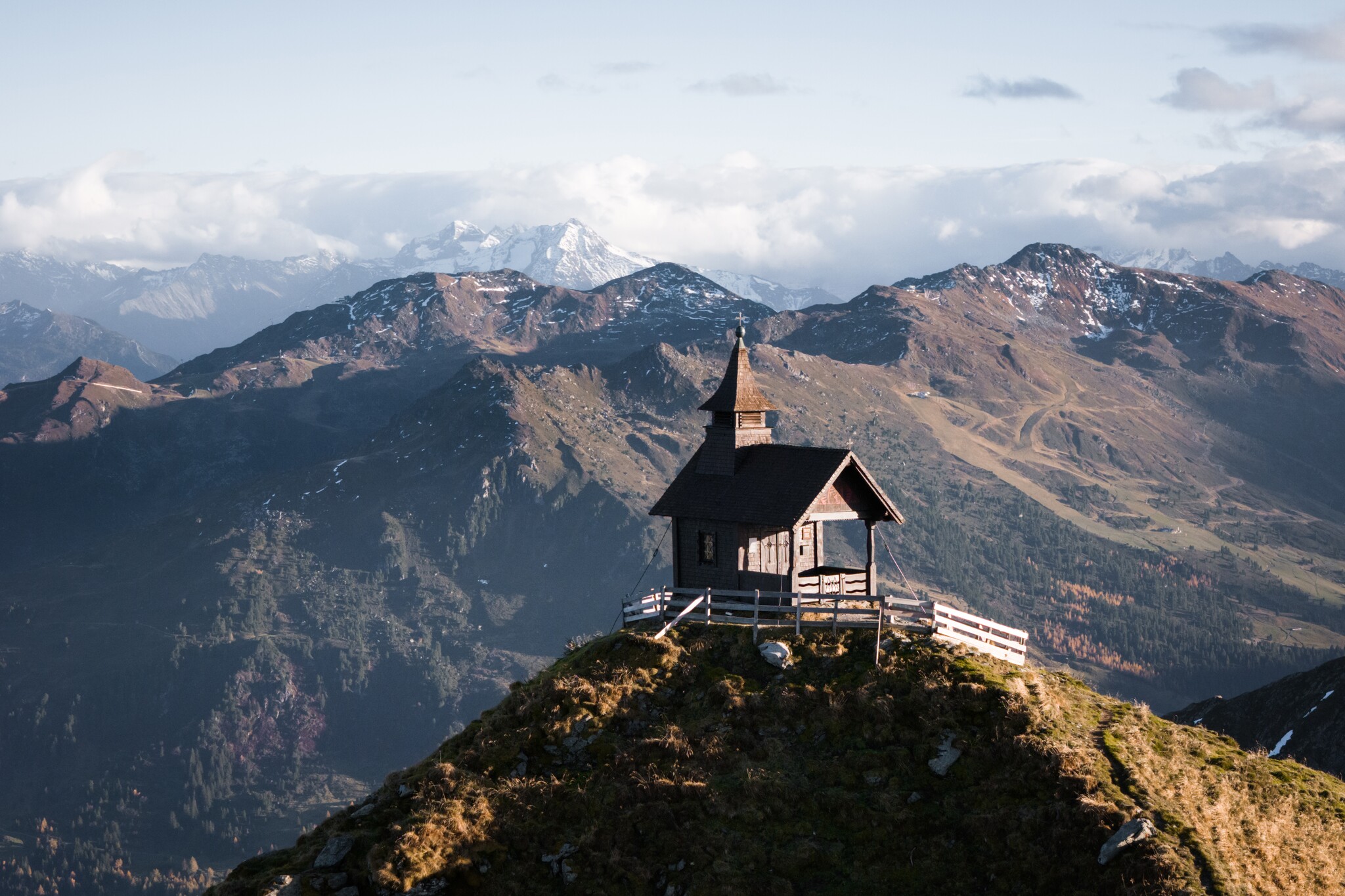
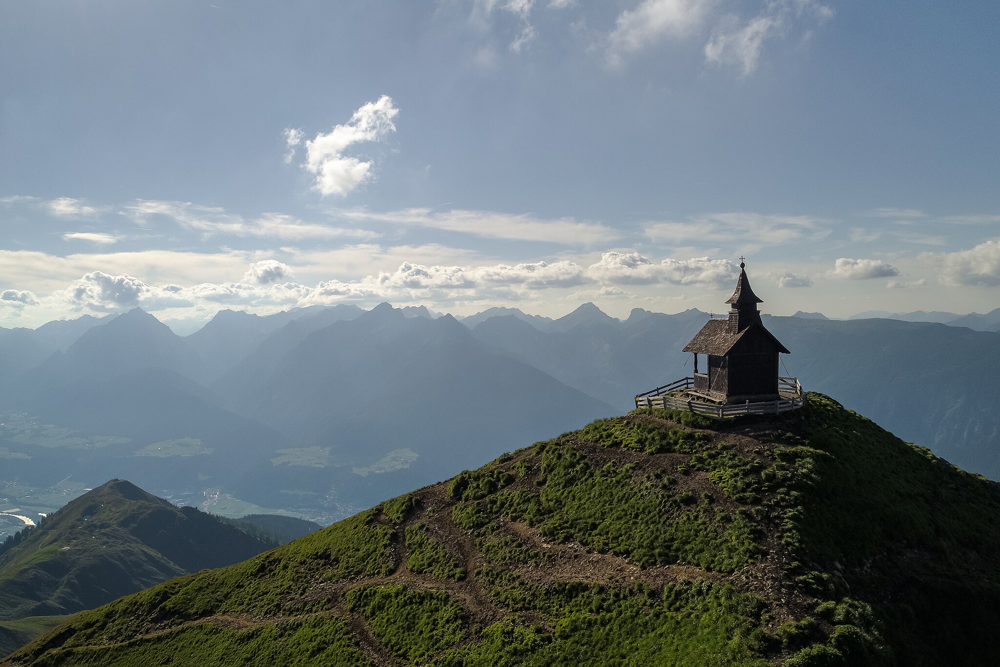
The Kellerjoch Chapel (2,344 m) is the highest chapel in Tyrol, one of the highest summit chapels in Europe and the landmark of the Kellerjoch – above Schwaz. It stands on the summit ridge between the Tux Alps and the Karwendel and offers a unique 360° mountain panorama.
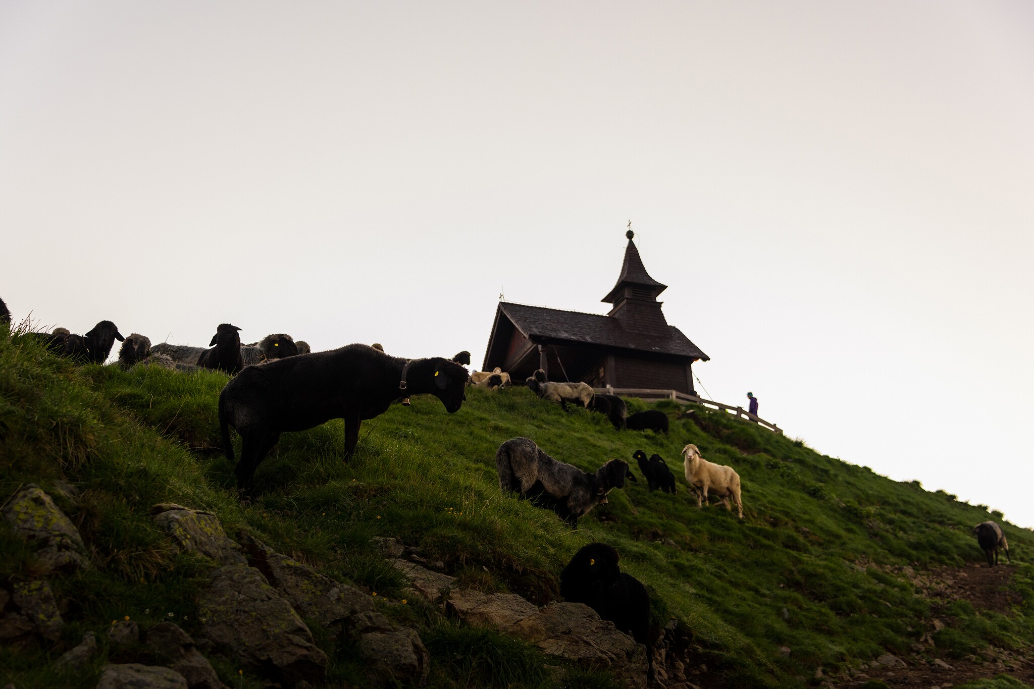
The ascent to the chapel is only suitable for sure-footed mountain hikers with a head for heights. Those who reach the summit are rewarded with an impressive view of the Inn Valley, the Karwendel, the Zillertal Alps and far into the Central Alps.
Route information:
The classic ascent is via the Kellerjochbahn cable car to the mountain station or Hecherhaus, then via the Arbeser Kogel and the Naunzstand to the Kellerjochhütte and finally to the chapel. The final section requires alpine experience.
Interesting facts:
The Kellerjoch Chapel (2,344 m) is the highest chapel in Tyrol, one of the highest summit chapels in Europe and the landmark of the Kellerjoch – above Schwaz. It stands on the summit ridge between the Tux Alps and the Karwendel and offers a unique 360° mountain panorama.
The ascent to the chapel is only suitable for sure-footed mountain hikers with a head for heights. Those who reach the summit are rewarded with an impressive view of the Inn Valley, the Karwendel, the Zillertal Alps and far into the Central Alps.
Route information:
The classic ascent is via the Kellerjochbahn cable car to the mountain station or Hecherhaus, then via the Arbeser Kogel and the Naunzstand to the Kellerjochhütte and finally to the chapel. The final section requires alpine experience.
Interesting facts:
- Built in 1888, renovated several times
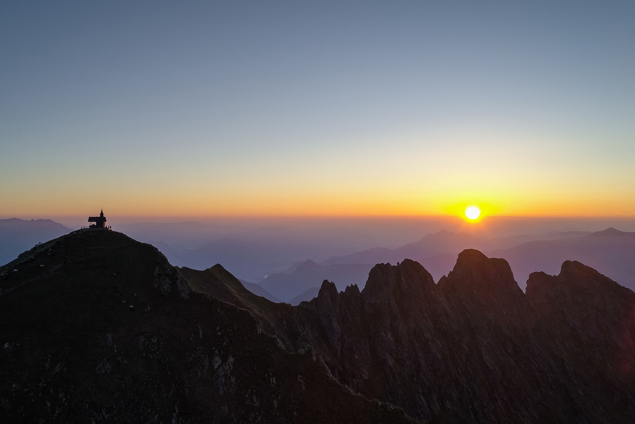
- Popular destination for sunrise and sunset hikes
- Combination with a stop at the Kellerjochhütte recommended

Contact | |
|---|---|
| Name: | Kellerjoch, Kreuzjoch |
| Postcode: | 6130 |
| Town: | Schwaz |
Getting there | |
|---|---|
| Getting there: |
|
| Public transport: | Take the regional bus or train to Schwaz station, then continue with the Bergbus 8 to the Kellerjochbahn valley station. |
| Parking: | Paid parkingspaces at the Kellerjochbahn orPillbergvalleystationsor on theLoas toll road |
Video | |
|---|---|
| Video URL: | www.youtube.com |
| Video Dauer: | 112 sec |