Family walks
Hike through gorges and ravines
Hiking & Mountain Tours
Leisurely walking
Pilgrimage route
The Austrian People’s Sports Association’s Permanent Trail
Themed trail
Through the Wolfsklamm to St. Georgenberg (IVV)
Medium
6,80 km
440 m
03:00 h
Description
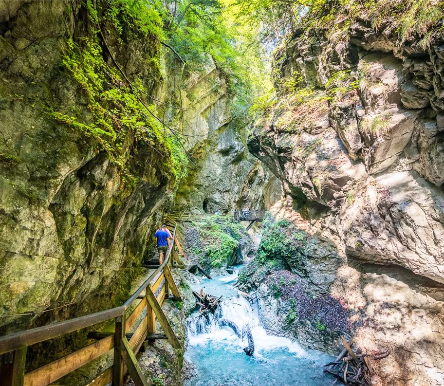
This adventurous hike takes you over around 350 steps, wooden walkways and rocky gorges alongside impressive waterfalls to Tyrol's oldest place of pilgrimage – the St. Georgenberg rock monastery. The thunder of the Stanser Bach stream and the power of the water give this hike through one of Tyrol's most beautiful gorges its special charm – and on hot summer days it is also pleasantly cool and refreshing.
- Walking time: approx. 3 hours
- Suitable for: families, nature lovers
- Recommendation: good footwear
Important information
Please note the opening hours of the Wolfsklamm
Best season
January
February
March
April
May
June
July
August
September
October
November
December
Elevation profile & characteristics
Technology
condition
Features
Family walk
Parking
Public transport: Train to Stans station – walk to starting point
Car: A12 Inntal motorway, Schwaz exit, continue to Stans and car park
Car: A12 Inntal motorway, Schwaz exit, continue to Stans and car park
- Wolfsklamm car park
- Laurentiuskirche car park
- Stans sports field car park
- Stans building yard car park
Equipment
- Good footwear
- Headgear/sun protection on hot days
- Drinking water
Public transport
Train to Stans station - walk to starting point
You can find the bus timetables at www.smartride.vvt.at
You can find the bus timetables at www.smartride.vvt.at
Instructions
Tour route:
- From the starting point at the car park, the route is initially only slightly steep
- After approx. 20 minutes, you will pass around 350 steps, narrow wooden walkways and galleries through the gorge.
- Walk alongside impressive waterfalls to an idyllic stream bed (ideal for a short break).
- Continue over an imposing wooden bridge to Tyrol's oldest place of pilgrimage, the St. Georgenberg rock monastery
- You can return via the Way of the Cross via "Weng"
For safety reasons, hiking downhill through the gorge is not permitted!
Author's tip
This hike is a permanent trail of the Austrian Volkssport Association (ÖVV).
These are marked hiking trails that you can hike independently at any time with a start card and route map. There are checkpoints along the way, and at the finish line you will receive an IVV rating stamp for each route – ideal for personal participation and kilometre ratings as well as shared hiking experiences in nature. More information at https://oevv-wandern.at/
These are marked hiking trails that you can hike independently at any time with a start card and route map. There are checkpoints along the way, and at the finish line you will receive an IVV rating stamp for each route – ideal for personal participation and kilometre ratings as well as shared hiking experiences in nature. More information at https://oevv-wandern.at/
Trail conditions
Well-maintained, partly narrow hiking trail with wooden steps
Medium
Route
6,80 km
440 m
443 m
03:00 h
900 m
start
car park Wolfsklamm
Destination
St. Georgenberg Pilgrimage Monastery